Brians238
Skilled Investigator
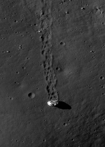
Well--it's a rolling boulder. Other than that, I'm not sure that there is anything special about the pic.
NEW! LOWEST RATES EVER -- SUPPORT THE SHOW AND ENJOY THE VERY BEST PREMIUM PARACAST EXPERIENCE! Welcome to The Paracast+, eight years young! For a low subscription fee, you can download the ad-free version of The Paracast and the exclusive, member-only, After The Paracast bonus podcast, featuring color commentary, exclusive interviews, the continuation of interviews that began on the main episode of The Paracast. We also offer lifetime memberships! Flash! Take advantage of our lowest rates ever! Act now! It's easier than ever to susbcribe! You can sign up right here!
Well--it's a rolling boulder. Other than that, I'm not sure that there is anything special about the pic.
Is it correct that one of the most likely theories on how our moon formed is that during an interplanetary collision, a chunk of the earth (where the Pacific Ocean is) ripped out and obtained an orbit around us?
Right on. And thank you for the information.The Giant Impact Hypothesis (GIH) is still the leading contender when it comes to theories of the moon's formation. In the original version of this theory, the moon was formed from debris ejected after the earth collided with a Mars-sized, world, Theia. However, there is an almost zero chance that rocks from Theia and rocks from Earth had the same isotopic ratios. Apollo astronauts found the rocks from the earth and the moon had identical isotopic ratios, suggesting a more complex origin for the moon. One recent theory suggests multiple collisions and re-collisions with very large objects, but the jury is still very much out...
Sorry Goggs! I should have read the thread to get the name right.
The image you provided is the famous Vitello boulder. There are lots of boulder tracks on the Moon and some on Earth. I always have found them interesting because they are supposedly from millions of years ago. The LRO (Lunar Reconnaissance Orbiter) captured the Vitello boulder very well and shows its source. The spot is at 30.4977 deg South and 37.5319 deg West.
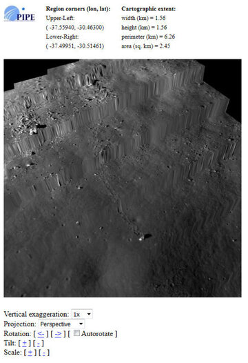
The below link is to the LRO image viewer (ACT) and the image at 1m resolution. (sorry for the long link, but those are the controls for the viewer)
QuickMap
You can move the viewpoint around and measure the distance it travelled from the rock outcrop as 850 m. Using the toolbar in the upper right corner, you can draw a box around it (pick about 2 km square) and get a topographic overlay image. This shows it is downhill from the outcrop to where it stopped. You can then click on the 3D visualizer and move it around in 3D. This 3D data is from the LOLA instrument of LRO which has been bouncing laser shots off the moon surface since LRO got in orbit. They do not interpolate the laser data to create a nice surface.


 . And BTW welcome to the forum
  !
!